| Bouïra Province ولاية البويرة | |
|---|---|
| — Province — | |
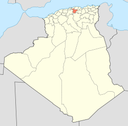
| Map of Algeria highlighting Bouïra | |
| Coordinates: 36°23′N 3°54′ECoordinates: 36°23′N 3°54′E | |
| Country | |
| Capital | Bouïra |
| Government | |
| • PPA president | |
| • Wāli | |
| Area | |
| • Total | 4,439 km2 (1,714 sq mi) |
| Population (2008)[1] | |
| • Total | 694,750 |
| • Density | 160/km2 (410/sq mi) |
| Time zone | CET (UTC+01) |
| Area Code | +213 (0) 26 |
| ISO 3166 code | DZ-10 |
| Districts | 12 |
| Municipalities | 45 |
Geography
It is located in the geographical heart of the province. It borders the municipality of Ait Laziz in the north, Aïn Turk in the north-east (home to the largest aqueduct in Africa), Aïn El Hadjar in the east, El Hachimia in the south-east, Oued El Berdi in the south, El Asnam in the south-west, Haizer in the west, and Taghzourt in the north-west.


No comments:
Post a Comment